Foster City Historical Society
  • Membership
  • About
  • Support Us
  • Categories

Foster City Historical Society

Preserving the past, looking to the future.

Browsed by
Tag: maps

1974 Map w/ Southern Crossing & Marina

1974 Map w/ Southern Crossing & Marina

April 9, 2022 Evan Adams

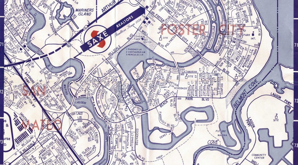
1974 Map of Foster City found in the Foster City Historical Society archives including the Southern Crossing, Sea Cloud II Marina & Marine World Africa USA

Recent Posts

  • Foster City Bridges
  • Independence Day Through The Years
  • Foster City Recreation Center Construction (photos) (1974-1976)
  • Foster City Post Cards “Scenes at Audubon” (1976)
  • Foster City Gives Youth an Advisory Role and a Voice
  • Twitter
  • Instagram
  • Facebook
  • Mail

Archives

  • July 2023
  • June 2023
  • April 2023
  • March 2023
  • February 2023
  • January 2023
  • December 2022
  • October 2022
  • September 2022
  • July 2022
  • June 2022
  • May 2022
  • April 2022
  • March 2022
  • February 2022
  • January 2022
  • December 2021
  • November 2021
  • October 2021
  • August 2021

Categories

  • Buildings (13)
  • Contest (3)
  • Documents (10)
  • Events (11)
  • Goverment (13)
  • Maps (11)
  • Nature (4)
  • People (9)
  • Video (5)

4thofjuly 1950's 1960's 1970's 1980's 1990's 2000's bae Beach Park Plaza Bikes bridge Bridgepointe buisness chamber of commerce crime economy Education engineering Erkenbrack family Fashion Island Mall federal foster city Kids leojryan maps Metro Tower nature parade parks Planning Recreation retail San Mateo school

© 2023 | Proudly Powered by WordPress | Theme: Nisarg